As a recap from the last post – I took three days with my husband Jordan the week of Thanksgiving to head to Death Valley and back – you can view the first post here.
You can see the route we took over those three days below.
Day 2
After a quick breakfast at the hotel cafe, we hit the road to the national park around 8:30am. We took the south entrance in, looping into the park just north of Shoshone on Jubilee Pass Road. This road felt like the windiest road of the whole trip so far but I think it was just a little twisty with a lot of distractions. It swoops and curves through stunning vistas as it slopes down into the valley.
Ashford Mill Ruins
The first point of interest on the south end of the park are the Ashford Mill Ruins. The ruins are one of the less popular sites in the park, mostly due to their location (about 12 miles south of Badwater Basin). In the early 1900s the Ashford Brothers had a small settlement here where they processed ore, and a few remnants of the buildings remain here. As a bonus, there’s also a bathroom at this stop!
[FinalTilesGallery id=’15’]
Badwater Basin
Badwater Basin is 282 feet below sea level – the lowest point in North America. Unlike being at high elevations, you can’t really tell. It’s a little weird to see the “Sea Level” sign up on the cliff – but otherwise you would have no idea how far below average elevation you are.
The salt seems to go on forever – the basin covers roughly 200 square miles. If you look closely, you can see little veins of salt crystals peaking out from the surface. The park allows visitors to go out along the salt flat in a cordoned-off area, and they are serious about preserving the expanse beyond it. While it kind of kills the mood of being in Death Valley to be surrounded by other tourists, it’s this preservation tactic that makes it even possible to take a photo where you look completely lost in the flats.
[FinalTilesGallery id=’16’]
Devil’s Golf Course
I was somewhat apprehensive about going out to the Devil’s Golf Course, since it’s a little over a mile off the paved road and we were on street bikes, but the dirt looked hard packed and I was feeling adventurous so we went for it. The golf course takes its name from a saying that “only the devil could play golf” on its rocky surface. Large chunks of salt and dirt are shaped by dry desert winds into the a totally extra-terrestrial landscape. If you put on a motorcycle helmet, you can pretend like it’s the moon!
[FinalTilesGallery id=’17’]
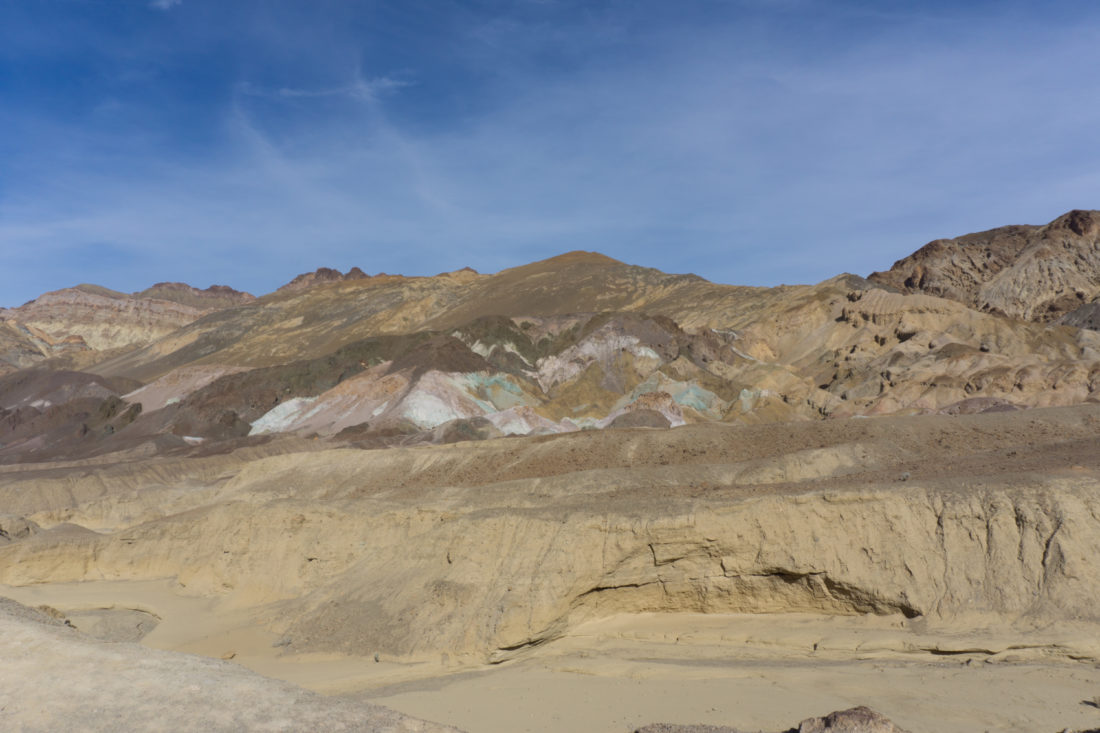
Artist Palette Drive
As you keep driving north, you start to get out of the deepest depths of the basin and into just a regular old giant, picturesque valley of wonder. We were starting to get hungry at this point, but before we headed to the restaurant at Furnace Creek we had one more spot on the agenda: the Artist Palette.
It’s sort of unbelievable how the colors of this hillside literally pop out amongst each other like someone painted them. In fact, for a moment I saw where Leonard Knight’s inspiration for Salvation Mountain came from! Pinks, blues, purples, reds…all these shades mingling together on this one mountainside in this one canyon – it’s no wonder there’s a road dedicated specifically to seeing this natural wonder.
As you head out of the Artist Drive, you’ll be bothered by how many slow drivers are blocking this teeny tiny stretch of glorious, tight twisties. But it’s for the best – because if you slow down and look around, you have the opportunity to see crazy gradients and stunning views while you’re descending back into the valley.
Furnace Creek Visitor’s Center
Unlike the Grand Canyon and Joshua Tree, Death Valley doesn’t have any manned checkpoints as you enter the park (at least on the east side). There are a few machines dotting the park where you can buy day passes, but if you’re after the multi-park annual pass (like we were) you have to go to the visitor center (or buy one online before you go)! I had every intention of going to the visitor center anyway, because I like to buy silly things for my dog sitters and see if I can find any cheesy gifts for my brother, so that wasn’t really a big deal for me. In 2017 I have been to 3 national parks, two of them twice, so I was more than due to make the plunge into becoming an annual member. As a bonus, the annual pass also counts as a national forestry pass (or Adventure Pass as they call it for the Cleveland National Forest in San Diego County), so I won’t have to spend another $30 for one of those as we get into primo hiking weather.
Near the Furnace Creek Visitor’s Center is a cafe, a golf course, and some lodging options. We ate a quick lunch at the cafe and took a look at the map to plan the end of our day. Initially, we’d planned to keep going north for a bit and head out toward Beatty, Nevada, but it was already 2:30 p.m. (somehow) and we only had two-ish hours of daylight left. While the temperatures were mild, the days in November are shorter than you think! We opted instead to get up to Dante’s View for a look over the basin, and then head back to Pahrump before the sun was down for too long.
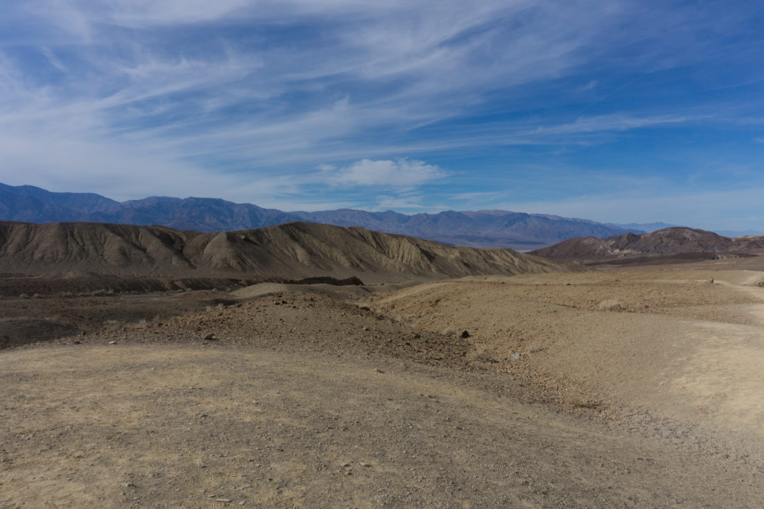
Dante’s View
Zabriske Point is on the way to Dante’s View from Furnace Creek, but it was looking mighty crowded so we just cruised on by this famous stop. As we headed up the turnoff to Dante’s View (Furnace Creek Wash Road), we saw the remains of Billie Mine. This was the last operating mine in Death Valley – it ceased borax mining in 2005. It’s just outside of the park boundary in the former mining town of Ryan. I really wanted to see if we could find a road to it, but there were some clearly visible “PRIVATE ROAD” signs, and it was a little late in the day for wandering off-road on street bikes without cell phone reception.
As you wind your way up the side of the mountain toward Dante’s view, it’s hard to imagine being down in the lowest point just a few hours ago. The desert flora gets a little more brush, the roads are narrow and twisty, and you’re faced with an imposing steep grade up toward the parking lot.
It’s totally worth the trip though, as you can see forever from up here. It’s amazing to look down at the little stripe in the Badwater Basin and think “I JUST walked on that!” Death Valley has a way of making you feel insignificant and easily defeated at every turn, and this one was no different.
[FinalTilesGallery id=’18’]
Amargosa Valley/Opera House
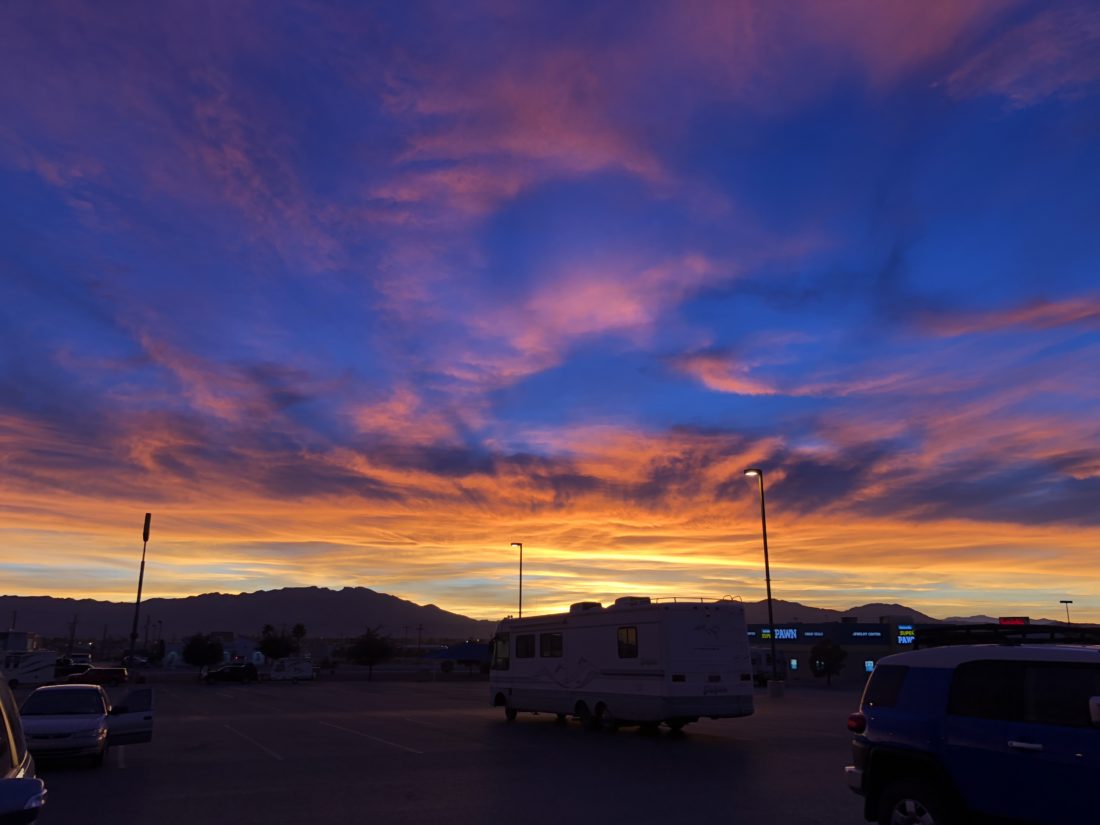
I’d thought we might stop by the Armagosa Opera House for some photos on our way back, but the temperature was dropping and I was ready for a beer so we just went by it. Some other time, I would love to explore this still-operating hotel, but not on this trip!
We pulled into Pahrump just in time to catch one of the most phenomenal sunsets I’ve ever seen. Pinks and purples lit up the desert sky – framed by the mountain ridges in the distance.


 Boot Review")
1 Comment
Pingback: Ride Report - Death Valley on a Motorcycle: Part 3 | Red Rag Garage